What is GIS?
So, what exactly is GIS?
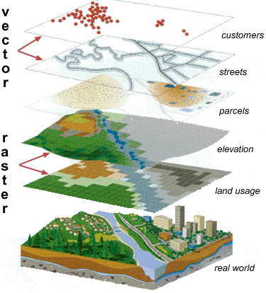
GIS is an acronym for Geographic Information Systems. GIS is an organized collection of computer hardware, software, geographic data, and personnel designed to efficiently capture, store, update, manipulate, analyze, and display all forms of geographically referenced information. In simpler terms, GIS stores geographics data such as roads, rivers, parcel boundaries, and aerial photography as thematic layers to a map. Often times, tabular data can be related geographically and thus tied to these thematic map layers (e.g. addresses, parcel numbers, geographics names, etc.). The user can then choose which thematic layers and tabular relationships he/she wants to display and analyze thus creating specialized maps for specific applications.
GIS is fundamentally used to answer questions and make educated decisions. With the vast sources of information available today, GIS is a key tool in determining what it all means. People access GIS to:
- measure change
- perform spatial analysis
- perform spatial modeling
- obtain decision support
Visit ESRI online to learn more about GIS!